Showing 17–30 of 30 resultsSorted by latest
Ins Kleine gebrachte Karte von den Sud-Landern zur Historie der Reisen Bellin, Jacques Nicholas [Leipzig], 1753.
Copperplate engraving, 205 x 275 mm, original folds, mild browning to left margin, otherwise fine.
The scarce German version of Bellin’s map of Australia, Carte reduite des terres Australes. The projected eastern coastline joins the charted territories on Van Dieman’s Land and Carpentaria.
First published in Prevost’s L’Histoire Generale des Voyages in the same year, editions in German, Danish and Dutch editions soon followed. Not in Tooley (although cf. Tooley 156/157/157a for French, Dutch and Danish editions); Clancy 6.28.
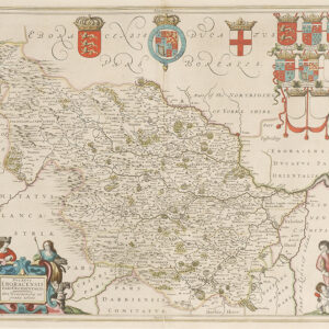
East Yorkshire
Hand coloured copper engraving
Jansson
1640
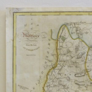
A map of Middlesex from The Best Authorities
John Cary 1754 – 1835
Engraved by E. Noble for Cary’s maps in Camden’s Britannia of 1789.
Original hand colour with water stain to top right. Otherwise fine condition. No repairs.
1789
40 cm x 52 cm
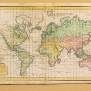
Delamarche
Hand coloured engraving
1790
41 cm x 28 cm
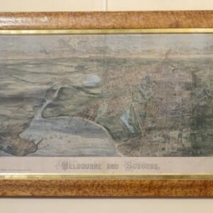
Having fantastic original colours, slightly foxing and housed in a birds eye maple frame.
A supplement to ‘The Illustrated Australian News’ July 1873.
Engraved by C.E. Winston and E. Lee.
65 cm x 100 cm
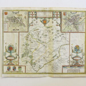
Rutlandshire with Oakham and Stanford her bordering neighbour Newely described.
Performed By Johan Speede, Solde by M.John Sudbury and George Humbell, in Popes head alley against the Exchange. Cum Privelegio.
John Speed 1552 – 1629
This map was first published in Speed’s Theatre of Empire Great Britain in 1611 – 1612.
English text on verso.
Good condition. Age toned. Early hand colour.
This edition 1646.
38.3 cm x 50.5 cm
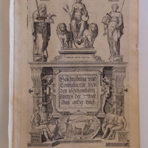
Nine 17th and 16th Century Atlas Title Pages in black and white
Measurements vary.
Hand coloured Planiglob der Erde map published by Weimar 1857
Hand coloured Deventer map by Jan Delate Kaart Vandetwee Platte Warelds Joolen 1700
Pair of hand coloured Coronelli (map maker) Planisfer del Mondo maps of the world 1691
Hand coloured Moithey Le Globe terrestre map 1760
Hand coloured Brookes Gaz Ateer’s new map of the world, showing the latest discoveries 1791
Hand coloured Betts Western/Eastern hemispheres map
De Lat Der Warelds Zooals hand coloured map 1700
Nieuw Stedeboeck Van Italien
Nouveau Theatre D’Italie
Tom I
1724
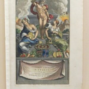
Nouveau Theatre D’Italie
Tom III
Contenant Les Royaumes
De Naples and De Siclie
Rutgert Alberts
1724
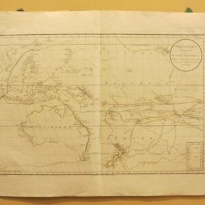
Polynesien Map
by
Daniel Djurberg
‘Ulimaroa’ – Aboriginal name for Australia
1785
84.5 cm x 62 cm (unframed)
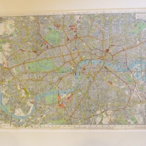
Mid 19th Century indicator map of London
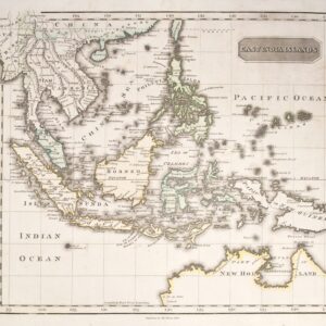
Attractive map of South East Asia, showing the northern part of New Holland, with de Wit’s Land, Van Diemen’s Land, Arnhem’s
Land and Carpentaria marked.
Copperplate engraving, original hand colouring, fine condition.Edinburgh
1810
32 cmx 36 cm (plate line)
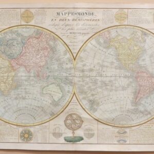
‘Mappe Monde en deux hemispheres’
by
Herrison
Large hand coloured double hemisphere world map
1856
78 cm x 55 cm (unframed)
![[MAP] Ins Kleine gebrachte Karte von den Sud-Landern zur Historie der Reisen - CDS750](https://allpressinc.com/wp-content/uploads/2021/01/IMG_3173_column_24-300x300.jpg)