
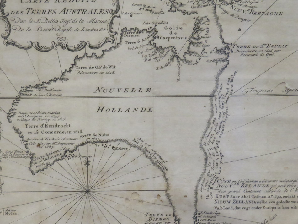
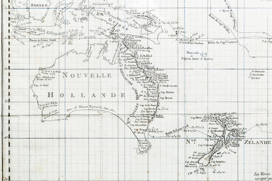
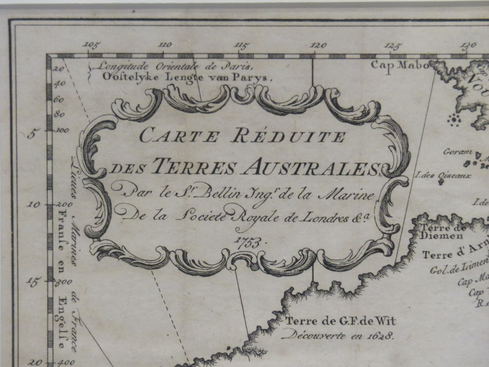
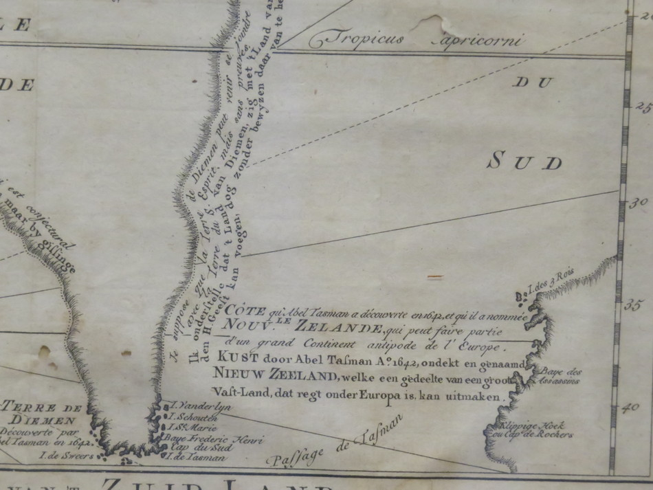
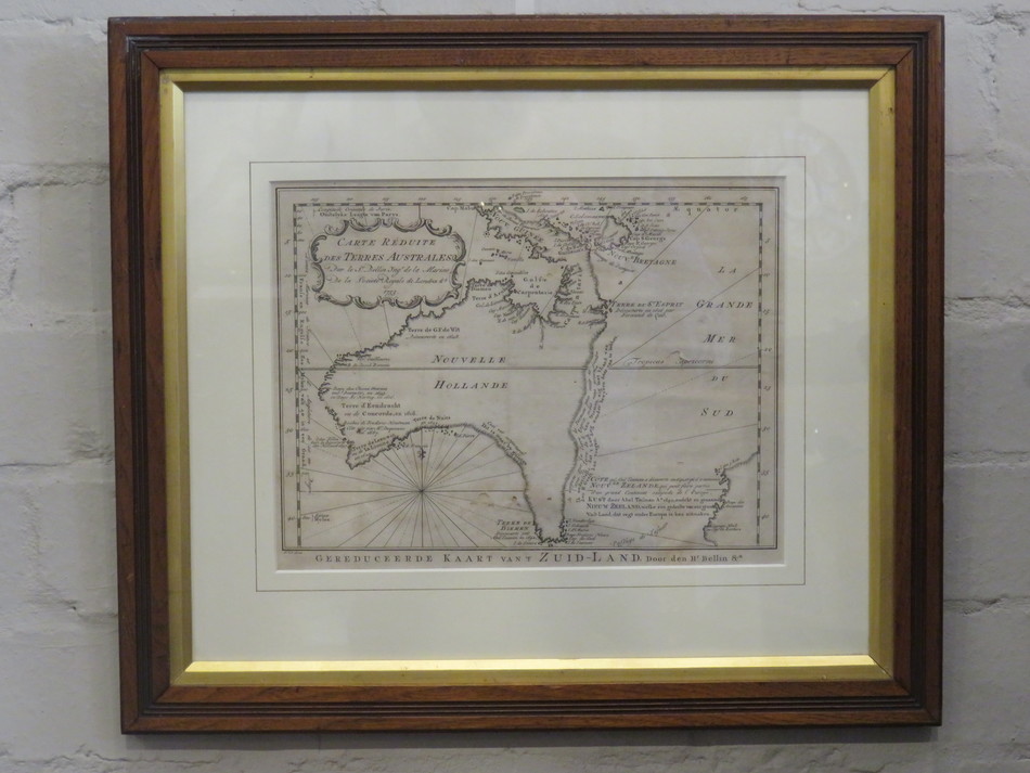
An 18th Century German Copper Engraved Map of Nouvelle Hollande (Australia) 1753
[MAP] Ins Kleine gebrachte Karte von den Sud-Landern zur Historie der Reisen
Ins Kleine gebrachte Karte von den Sud-Landern zur Historie der Reisen Bellin, Jacques Nicholas [Leipzig], 1753.
Copperplate engraving, original folds.
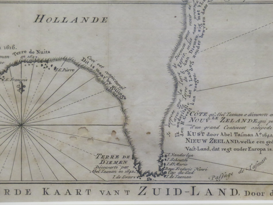
The scarce German version of Bellin’s map of Australia, Carte reduite des terres Australes. The projected eastern coastline joins the charted territories on Van Dieman’s Land and Carpentaria.
First published in Prevost’s L’Histoire Generale des Voyages in the same year, editions in German, Danish and Dutch editions soon followed. Not in Tooley (although cf. Tooley 156/157/157a for French, Dutch and Danish editions); Clancy 6.28.
1753
AA2064
205 x 275mm