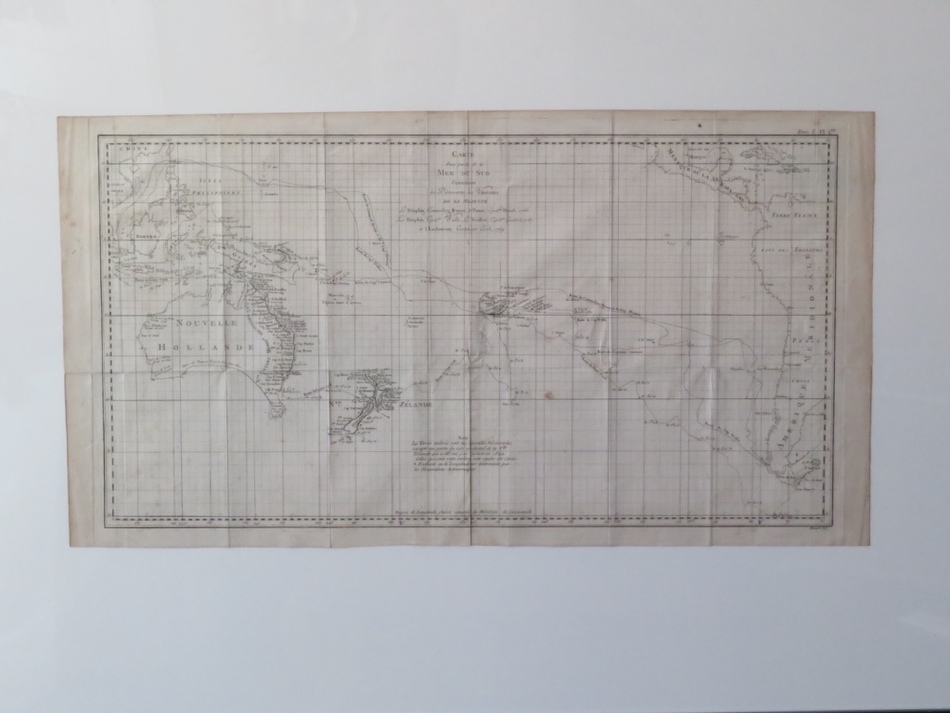
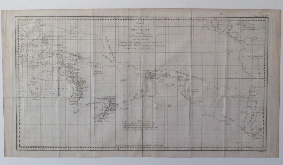
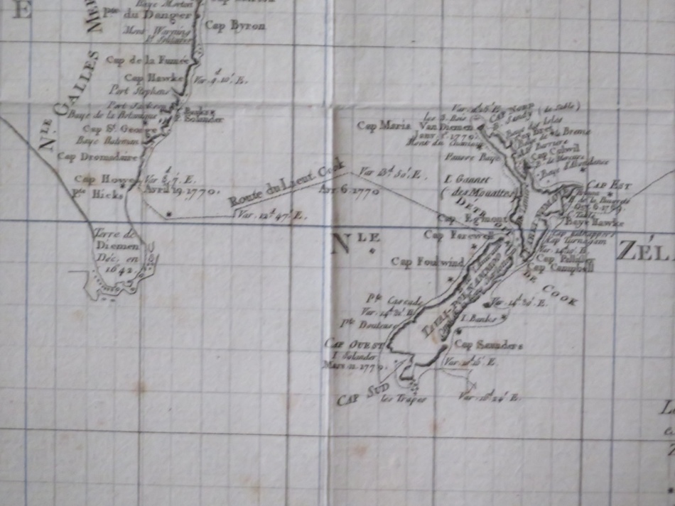
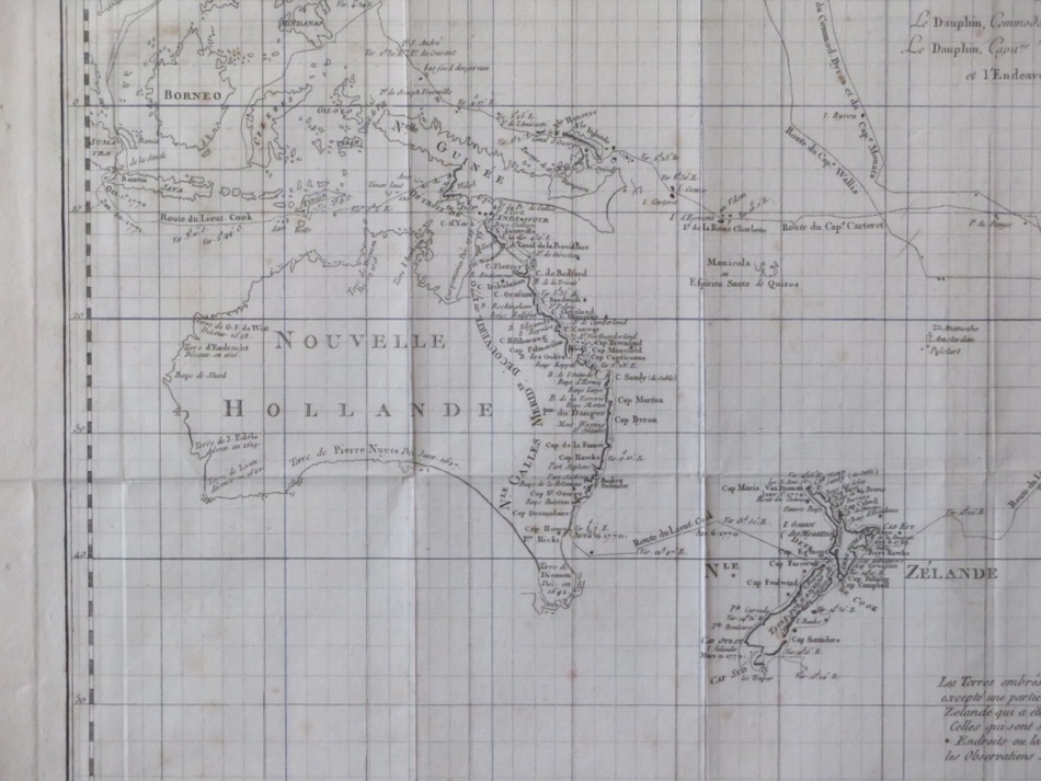
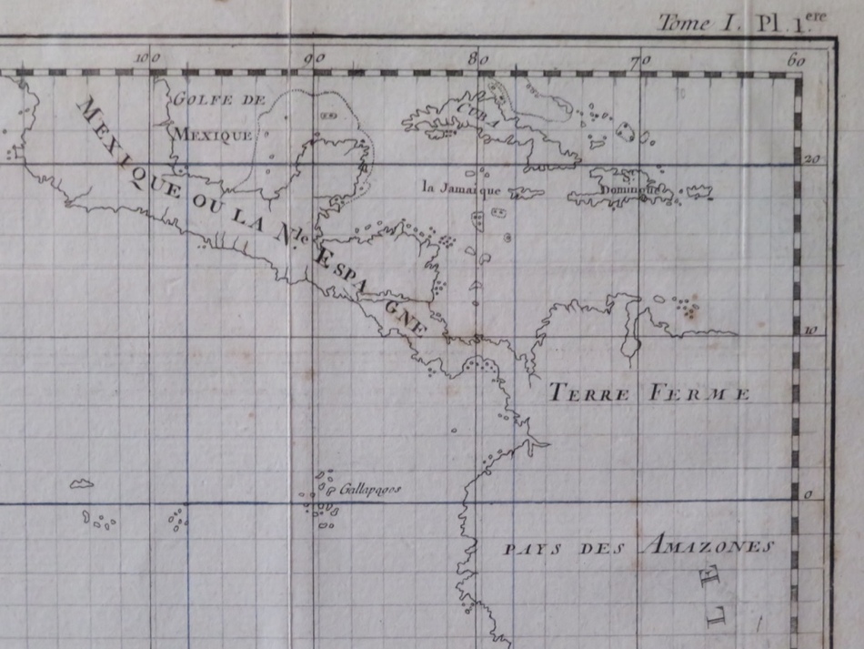
Rare Robert Bénard map of the South Pacific, showing Australia and New Zealand
BÉNARD, Robert.
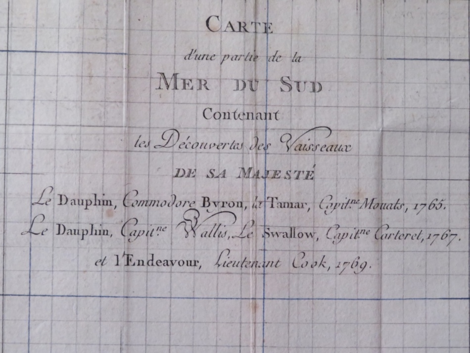
Carte d’une partie de la Mer du Sud Contenant les Découvertes des Vaisseaux de sa Majesté… Paris, Saillant et Nyon & Panckouke, 1774.
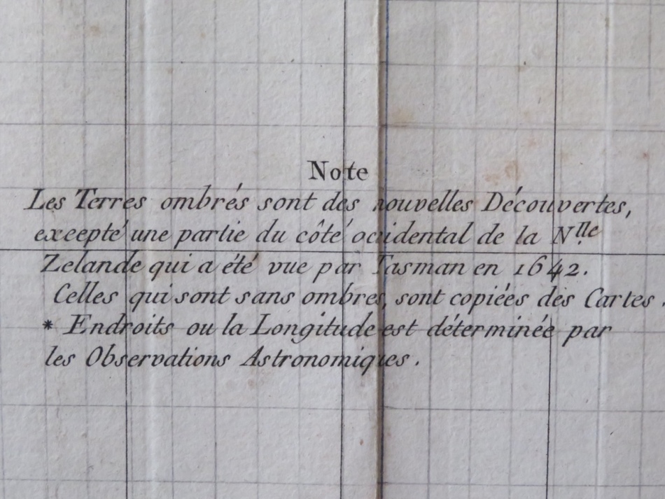
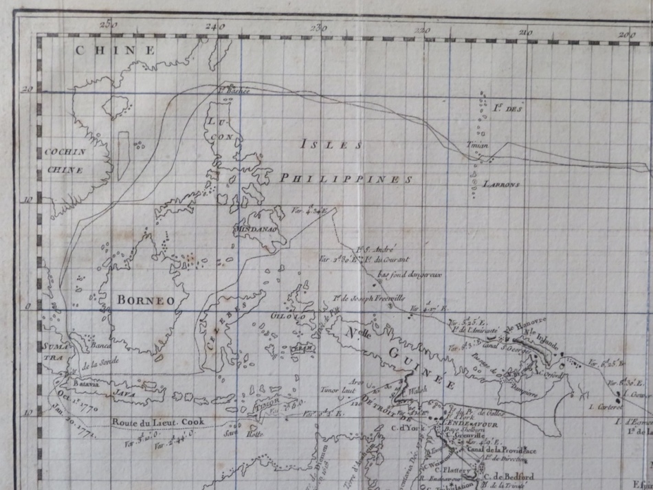
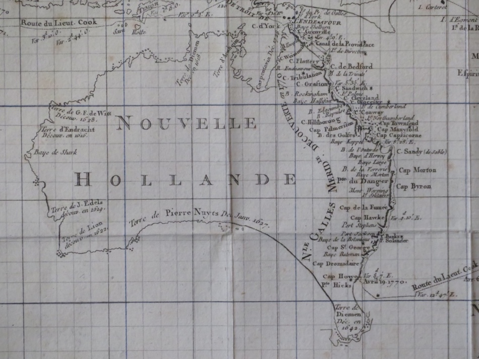
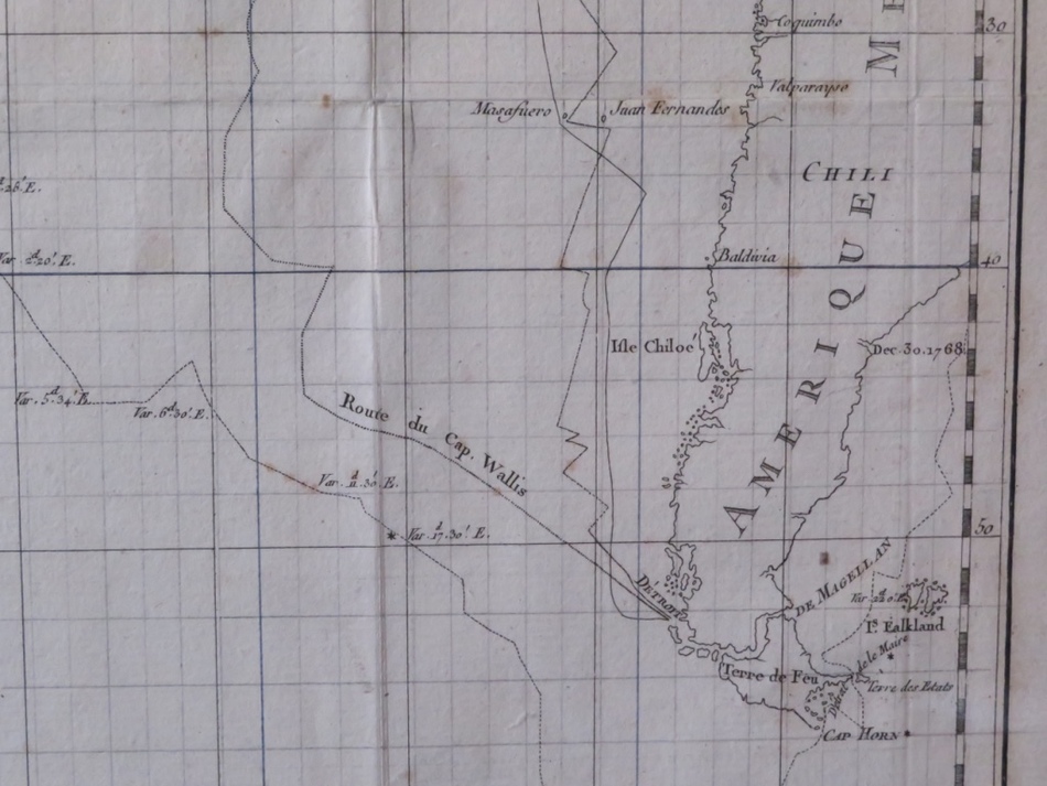
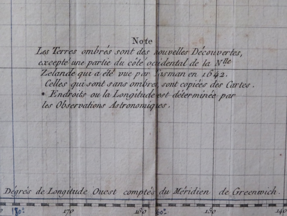
Antique chart of the South Pacific showing Australia and New Zealand, engraved by Benard for a French edition of Hawkesworth’s important work ‘An Account of the Voyages for Making Discoveries in the Southern Hemisphere, first published 1773.
The routes of Byron, Wallis and Carteret are shown, as well as Captain James Cook’s first voyage.
Map: 39 cm W. 73 cm
Framed: 74 cm W. 105 cm
Binding folds flattened as usual. Wide margins.