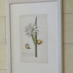
Trew – ‘Cereus’ – 1750
Cereus Plantae Selectae published by Cristoph Jacob Trew in Nuremberg in 1750. Copper engraving with original hand colour.
1750
Showing 225–240 of 466 resultsSorted by latest
Cereus Plantae Selectae published by Cristoph Jacob Trew in Nuremberg in 1750. Copper engraving with original hand colour.
1750
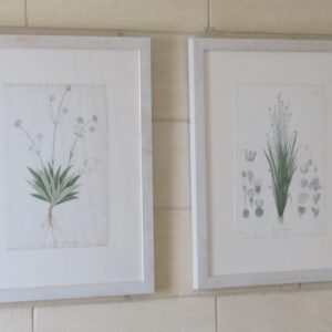
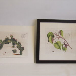
Pair of Englemann botanicals
C. 1830
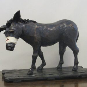
Stock CMT900
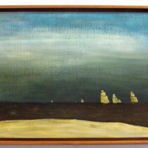
Simpson’s Donkey
Bronze
Martin Tighe 2012
H: 33 cm
W: 45 cm
D: 27 cm
Stock CMT604
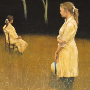
‘Waiting’
Martin Tighe
Acrylic on board
56 cm x 70 cm
Stock AA1538a
A 20th Century acrylic on board ‘group of distorted figures’, signed by R. Fihya ’73
1973
56 cm x 51 cm
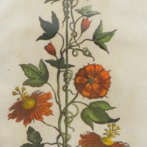
Munting Late 17thCentury hand coloured copper plate botanical engraving.
1696
‘Distant Figures (study)’
Martin Tighe
Acrylic on board
2011
52 cm x 39 cm
$1500.00
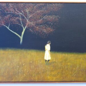
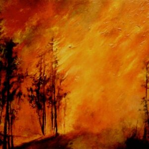
‘Flame Tree’
Martin Tighe
Acrylic on board
2011
109 cm x 85 cm
$4,500.00
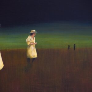
‘Off to Mow a Meadow’
(First Fleet)
Martin Tighe
2012
37 cm x 53.5 cm
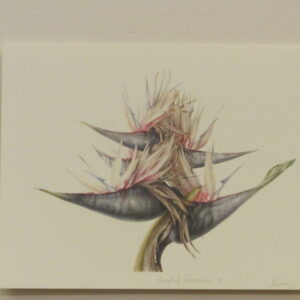
Mali Moir
Botanical, Scientific & Natural History Artist
Limited edition botanical prints of original watercolour 200/200
2000
21 cm x 29.7 cm
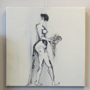
‘Heartbroken’
Carmel Jenkin, Melbourne Artist
Ink, Acrylic on Canvas
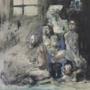
There are no obstacles in Carmel Jenkin’s work. Her nudes are for: ‘getting emotion out there’ . To achieve this, she brings the nude right up to the picture plane, to directly involve the viewer with the subject. While there is an element of abstraction in her work, the female ambience, as if the artist’s eye got so close she could see the nude as emotion in a series of curved shapes. These works are raw and immediate and usually have a distorted and linear form. They may portray a sense of naked angst but, at the same time, show possession of a deeply spiritual soul. At the risk of exclusionism one wonders if these works, drawn by a woman, are a language to be read and pondered by other women. Either way, Carmel Jenkin is engaged in a passionate journey of artistic and life discovery through the female body.
2012
$1,900
56 cm x 56 cm
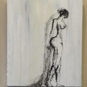
‘Wandering This Path Alone’
Carmel Jenkin, Melbourne Artist
Ink, Acrylic on canvas
There are no obstacles in Carmel Jenkin’s work. Her nudes are for: ‘getting emotion out there’ . To achieve this, she brings the nude right up to the picture plane, to directly involve the viewer with the subject. While there is an element of abstraction in her work, the female ambience, as if the artist’s eye got so close she could see the nude as emotion in a series of curved shapes. These works are raw and immediate and usually have a distorted and linear form. They may portray a sense of naked angst but, at the same time, show possession of a deeply spiritual soul. At the risk of exclusionism one wonders if these works, drawn by a woman, are a language to be read and pondered by other women. Either way, Carmel Jenkin is engaged in a passionate journey of artistic and life discovery through the female body.
2011
$1,900
61 cm x 51 cm
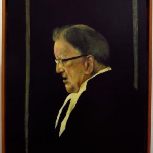
Martin Tighe’s entry to the 2012 Archibald prize at the art gallery of NSW, Sydney
Subject Brian Bourke, distinguished Melbourne barrister, over 50 years at the Victorian bar.
Barrister in over 55 murder trials including Ronald Ryan’s in 1966.
49 cm x 43 cm
Hortus Indicus Malabaricus
Hendrik Draakestein.
The first complete flora from the East Indies. A very fine example of copper engraving.
Amsterdam
1686
46 x 38 cm (unframed)
Stock CLC601
‘Wild Beauty’
Lydia Ciconte
Acrylic on canvas
2009
188 x 249 framed
Stock CGW381503/2
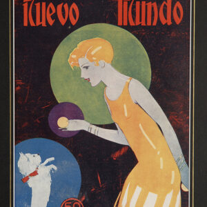
Nuevo Mundo Spain 1920’s
These magazine covers are a wonderful documentation of early 20th Century art showing exploration in both vibrant colours and composition. Many of the artists gained acknowledgement through this work and went on to successful careers including work on the more famous Vogue covers. By the very nature of these publications most were thrown away making these very scarce items (colour process prints).