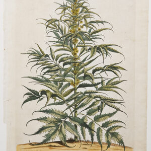
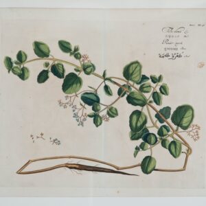
Elizabeth Blackwell (nee Blachrie) was among the first women to achieve fame as a botanical illustrator.
She was born in Aberdeen in about 1700, but moved to London after she married.
She undertook an ambitious project to raise money to pay her husband’s debts and release him from debtors’ prison. Her project was a book called ‘A Curious Herbal’.
She learned that physicians required a reference book which documented the medicinal qualities of plants and herbs. In order to develop the publication she examined and drew specimens of plants available in the Chelsea Physic Garden. Sir Hans Sloane provided financial support to publish ‘A Curious Herbal’.
Elizabeth Blackwell is notable for being one of the first botanical artists to personally etch and engrave her own designs. This saved the expense of hiring a professional engraver. In total, the enterprise took Blackwell six full years to complete and in the end she was able to release her husband from prison.
‘A Curious Herbal’ was published between 1737 and 1739. The book contained the first illustrations of many odd-looking, unknown plants from the New World.
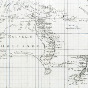
[MAP] Ins Kleine gebrachte Karte von den Sud-Landern zur Historie der Reisen
Ins Kleine gebrachte Karte von den Sud-Landern zur Historie der Reisen Bellin, Jacques Nicholas [Leipzig], 1753.
Copperplate engraving, original folds.
The scarce German version of Bellin’s map of Australia, Carte reduite des terres Australes. The projected eastern coastline joins the charted territories on Van Dieman’s Land and Carpentaria.
First published in Prevost’s L’Histoire Generale des Voyages in the same year, editions in German, Danish and Dutch editions soon followed. Not in Tooley (although cf. Tooley 156/157/157a for French, Dutch and Danish editions); Clancy 6.28.
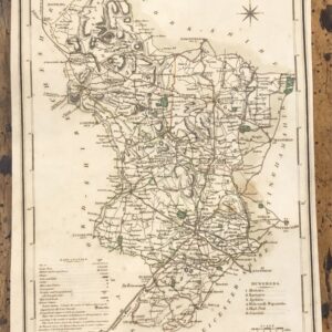
Early 19th Century Map Engraving of Derbyshire 1805
A highly detailed and attractive early 19th Century map of Derbyshire, with fine original hand colour, which was drawn and engraved by G. Cole and J.Roper, respectively, and published in the British Atlas (London: Vernor, Hood & Sharpe, 1807 / 1810).
City of Lichfield, Town of Derby,Borough of Burton and Villiage of Ashton.
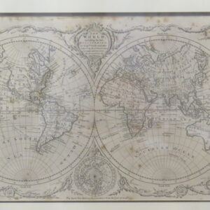
A Framed Copper Engraved World Map by Thomas Bowen 1780 “The World including the late discoveries by Captain Cook and other circum navigators. Carefully laid down to the present time by Thomas Bowen”
Framed H. 47 cm Framed W. 65 cm Map H. 29 cm Map W. 48cm
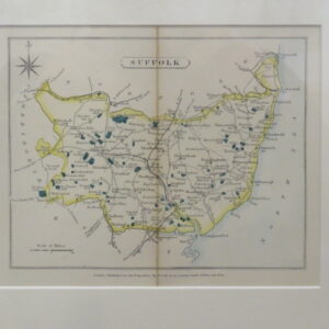
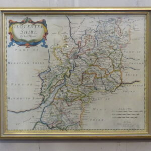
A Framed Map of ‘GLOUCESTER SHIRE By Robert Morden 1695 – 1730 An interesting and attractive framed hand coloured copperplate engraving map of Gloucestershire First published by Robert Morden in 1695, which appeared in Camden’s Britannia (London: Swale, Awnshaw & Churchill, 1695 – 1772) H. 40 cm W. 47 cm
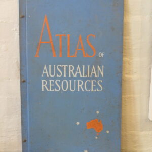
A Very Large Important ‘Atlas of Australian Resources’ Featuring full colour illustrations of mineral deposits, soils, rainfall, temperatures, agriculture, population, forest, railways, drainage and much more.